We start from the village Kefalari. The trail starts at the mountain hostel to the left of the main square next to a church. There is no climbing sign that shows us the way to go, but the path is visible. We leave right from the hostel and ascend crossing twice a stream without water. At the beginning of the trail we meet a fountain for animals and some trail signs. Soon you will find an old metal sign on a pine. Then, after passing through a narrow passage between hedges, we reach a forest road.
Pass across the plateau and continue our march to the left towards the stream. We go right via a slippery path. Soon we reach a plateau with small trees where we find ribbons tied to branches. Pay attention as in some places the path is blocked by dense vegetation. It is better to move along the branches or we can easily lose track.
We cross the fir trees forest and via a closed track to reach a large plateau. On the left a little farther there is a pen and forest road. We move to the right and follow the clump.
To find the entrance to the trail in the woods, we need to look for the well of Moutsios. There are ribbons and some red metal marks on trees. After a few openings in the forest we begin to ascend through a dry creek. The trail is generally well defined and with a little attention will lead us properly.
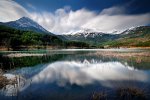
As we approach the alpine part, we find on our left some characteristic rocks, which bypass from the right, ascending towards the ridge that is easy and safe. We reach the saddle, where on our left we see the top “Dousias Mountain” while to the right and a little farther is the summit “Chioni”. In line with hiking maps the top “Dousias Mountain” is the tallest with a height of 2.088m. and follows the top of Chioni 2.086m. However, wooden climbing boards will find the on the way back state as the highest peak “Chioni” with height of 2.177m.
The truth lies somewhere in the middle and perhaps the highest peak is located between the two above and has no distinctive name. To return, we move to the right over the ridge until we reach the last peak (Chioni).
From here we either descend to the right passing by the peak or descend before it towards the neck on the right. Essentially, by measuring the necks from the top Dousias we must descend to the third we see to our right. To our left is the path.
We start the descent until we reach the stream Makria Chouni. Here we see the yellow signs from the path E4. Characteristic of the trail are the many broken and uprooted trees from the large amount of snow that fell in the winter of 2010-11. We descend a distinct path until we reach a forest road with a wooden sign. From there we will continue right towards the great plateau that we found at the beginning of the journey.
After about forty minutes we reach to a pen. Located to the left of the forest road, but we must continue right through the path. Animals have opened several passages and is difficult to recognize the right path. Next we enter the woods, moving parallel to the ridge, located at the bottom right.
Soon we will reach the plateau in front of a road leading to another pen. Beware of loose hounds, which bark but not approach. Passing to the left of the pen and following the forest road will go next to the well, we met at the beginning. From here we follow this path to the village, always following the ribbons on trees.
Source: www.mountainsgreece.com
Use the map or the alphabet below to find your favorite destination!
Achaea Prefecture
Aegina
Aetoloakarnania Prefecture
Agathonisi
Agistri
Alonissos
Amorgos
Anafi
Andros
Antiparos
Arcadia Prefecture
Argolida Prefecture
Arta Prefecture
Astypalea
Attiki Prefecture
Kalymnos
Karditsa Prefecture
Karpathos
Kasos
Kastelorizo
Kastoria Prefecture
Kavala Prefecture
Kea (Tzia)
Kefalonia
Kerkyra (Corfu)
Kilkis Prefecture
Kimolos
Korinthia Prefecture
Kos
Koufonisi (Ano & Kato)
Kozani Prefecture
Kythira - Antikythira
Kythnos
Samos
Samothrace
Santorini
Schinoussa
Serifos
Serres Prefecture
Sifnos
Sikinos
Skiathos
Skopelos
Skyros
Spetses
Symi
Syros
Would you like to combine skiing in the morning and then go swimming in the afternoon, all in one region? Click to choose your interests and see in which part of Greece you enjoy them. Combinations are endless!
